Blacks Beach CA
Part of Torrey Pines State Beach
Updated February 10, 2025 by San Diego Beaches and Adventures
Torrey Pines State Beach
Torrey Pines State Beach is really three different beaches with three different personalities:Torrey Pines Beach - an easily accessible family beach at the northern end, visible from historic 101 highway/North Torrey Pines Road.
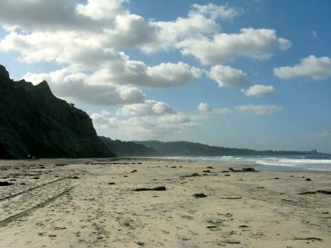
Blacks Beach State Beach - a secluded "unofficial" clothing optional or nude beach hidden beneath the Torrey Pines cliffs.
Blacks Beach City Beach - a popular surfing spot owned by the city of San Diego just south of Black's Beach State Beach, north of Scripps Pier and popular La Jolla Shores. This beach is officially called Torrey Pines City Beach.
This page will talk about Blacks Beach City Beach.
Blacks Beach City Beach General Information
Location: Pacific Ocean just south of Torrey Pines Gliderport, San Diego, CaliforniaDirections to Blacks Beach CA: see below | Google Map
Parking: Free parking at La Jolla Shores or Torrey Pines Glider Port (2800 Torrey Pines Scenic Dr.,La Jolla, CA 92037)
Getting There: Long walk, steep trail, or steep road. Carry everything in and out.
Things to Do: Walking, jogging, sunbathing, surfing.
Things to See: View of La Jolla coastline, dolphins, whales, watch the hangliders and paragliders soaring along the cliff from the Torrey Pines Glider Port , sunset over the Pacific Ocean, amazing cliff rescues of people who don't stay on the official trail
Facilities: None. No restrooms, no showers, no changing rooms, no trash cans.
Services: None. Bring your own food, sunscreen, beach equipment and surfboard. Just remember you get to carry it all back!
High Tide Access: Beach access from the south or north may be limited at high tides.
Lifeguard: Lifeguards sporadically patrol the beach but consider it swim-at-own-risk
Dogs: Dogs are allowed on this city owned section of Black's Beach before 9 AM or after 6 PM (4 PM from Nov. 1 - Mar. 31)
Things NOT to Do: No alcohol, no glass containers, no smoking, no littering, no disturbing noise, no beach fires, no overnight sleeping, camping or parking, no nudism (remember - this is the city owned portion of Black's Beach San Diego, and public nudity is not allowed here. You can be fined).
Disability Access: None.
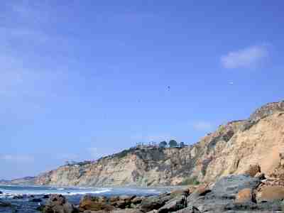
Hazards: Strong surf, strong currents, rip currents, steep unstable cliffs - stay back from cliffs as they can slide or large boulders can drop, and sometimes not the best view at the north end, depending on your point of view
Surfing La Jolla San Diego Black's Beach CA
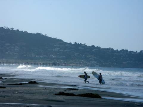
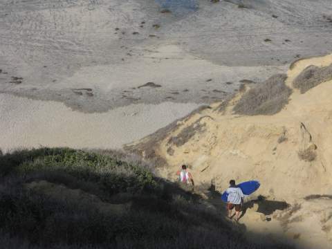
The southern end of Black’s Beach CA is famous to surfers for the big winter swell, but it in not for beginners. Motivated experienced San Diego surfers must carry their surfboards down the Torry Pines trail from the 300 foot bluff to the ocean below, and then up again when done. The surfers head south at the bottom of the Torrey Pines trail to Black’s Beach, while the nudists tend to head north, as most of the clothing optional portion of Black Beach San Diego is north of the trail.Surfers from UCSD like to walk down the steep 1/2 mile paved road from La Jolla Farms Road.
Mansions Above Blacks Beach CA
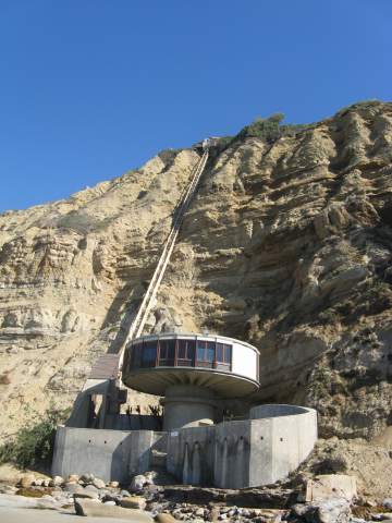
There are some spectacular mansions in the UCSD La Jolla Farms area above Black's Beach. The Salk Mansion shown above has an elevator down to the beach, and can be seen at the southern end of Black's Beach.Other mansions sit on the cliffs above the beach, and have their own private road to Blacks Beach, which is frequented by UCSD surfers heading to catch a wave.
Directions to Blacks Beach CA
The southern end of Blacks Beach CA is owned by the city of San Diego. This is NOT the clothing optional portion of Blacks Beach. It can be accessed from the south by walking up from La Jolla Shores beach at low tide, from the trail down from the Torrey Pines Glider Port , or from a gated private road near the University of California San Diego (UCSD) campus.
Directions to Blacks Beach CA from La Jolla Shores:
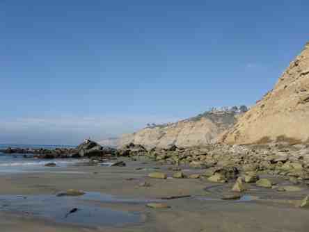
(The Long Way) Make sure the tide is not too high before you opt this route. This photo above was taken at MLLW 2 feet and shows the rocks and tidepools that must be crossed if you take this route. It is not passable at high tides. Take Interstate 5 north to La Jolla Parkway. Take a right at the intersection of La Jolla Shores Drive and a left on Calle Frescota to the free public parking lot at La Jolla Shores. This lot includes 350 spaces, including eight disabled parking spaces. If the lot is full, look for parking along the neighborhood streets. This is a popular beach so parking is scarce on weekends. Walk north one mile, through Scripps Beach, past the Scripps Pier, to Blacks Beach Torrey Pines City Beach.Caution - the cliffs can be unstable and the tide high can limit access. You do not want to walk too close to the cliffs, or be caught at high tide. The rocks are slippery. If you continue further north another 1/2 mile you will reach the state owned portion of Blacks Beach, which is clothing optional. If that offends you, be sure to stay in the southern portion. The clothing optional beach begins just south of the trail to the Torrey Pines Gliderport.
Directions to Blacks Beach CA from the Torrey Pines Glider Port Trail
(The Steep Way)This is my favorite route but the stairs are steep. Also, be aware that when you reach the beach you will be on the clothing optional portion of the beach for a short distance. If a nude beach offends you, don't go here.
Driving Directions: From Interstate 5 take Genesee west. Turn left on Torrey Pines Rd. then right on Torrey Pines Scenic Drive, just before the Salk Institute. Park in the unimproved parking at the end of the street at the Torrey Pines Gliderport above Black's Beach. Watch out for the big pot holes!
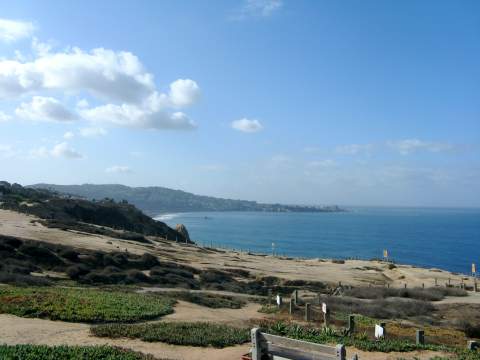
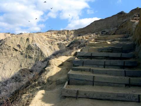
On the left side of the Torrey Pines Glider port are the public portable restrooms (the last ones you'll see). The trail is at the end of the parking area to the left of where all of the "unstable cliff" signs are located (far left in this photo above). When you reach the trail and sign above, you are at the official trail to Blacks Beach from the Gliderport. (The sign is not very welcoming, is it?) The trail is steep but has stairs and rails. Wear sturdy shoes, and if you plan to stay after sunset, bring a good flashlight for the hike back up.
Warning: do not take any trails except this one or you may get stuck on side of the cliff and suffer an expensive and embarrassing rescue, become seriously injured, or even die. This has happened to a number of people over the years.
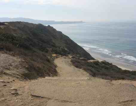
Trail to Black’s Beach CA: The trail is steep but when I was last there, the Blacks Beach trail was in great condition and well maintained. (Some websites report that this is an unimproved trail, but I disagree. This is an improved dirt trail with wooden supports and handrails, as you can see in the photos).After the 300 foot descent to the beach, go left. The city owned portion of Black Beach San Diego starts about 200 feet to the left by the large square rock. It may be marked with red cones.
Directions to Blacks Beach La Jolla from UCSD
This gated private road leads to the beach from La Jolla Farms Road. If you are lucky enough to live in a mansion in that area, be a UCSD student, or a lifeguard with a key, you’ll already know how to find this. The rest of us get to go the long way or the steep way. OK, this really is a nice way to go if you can find parking, so here are directions.
Blacks Beach CA Directions from UCSD - Take Interstate 5 at La Jolla Village Drive and go west. Follow that street as it curves right and becomes North Torrey Pines Road, go left at La Jolla Shores Drive then go right onto La Jolla Farms Road. Where La Jolla Farms Road meets Black Gold Road is the access road to Black's Beach CA. Most of the street is red which means no parking (if I lived in a mansion, I wouldn't want people parking on my street either!) There is limited street parking, and on weekdays it is 2 hour parking only.
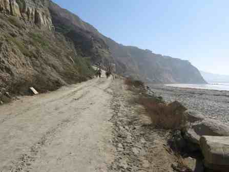
Walk down the steep paved road (Salk Canyon Road) for about 1/2 mile down to the beach, ending at the southern end of Blacks Beach City Beach. It is a popular route for UCSD surfers to walk to Black Beach La Jolla.
Welcome to San Diego
Happy 2025! Be sure to Like us on Facebook!
See our new Google map to San Diego attractions, including Disneyland and Universal Studios San Diego Attractions Map

San Diego Events - Don't miss out on these fun San Diego Events.
North San Diego County Beaches
Best Beaches in San Diego
Tides, Maps and Directions
Some beaches are best explored at low tide. Check out the tides and find maps and directions to the popular beaches below.
San Diego Beaches
These are the top beaches in San Diego, listed from north to south:
Blacks Beach (Nude beach)
Blacks Beach (Surfer beach)
La Jolla Seals at Children's Pool
North San Diego County Beaches
These are the top beaches in San Diego’s North County, listed from north to south:
More Things to Do in San Diego
